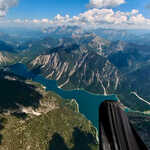
Tegelberg to Farchant XC Paragliding

On the second day at Tegelberg I had planned to fly east after take off, through the Ammergebirge and then with the aim of seeing how far east I could fly, as this would give me an easy journey back to Munich. Unfortunately as per the previous day, the day took a very long time to get going at Tegelberg which meant that I didn’t launch until 14:20. Thankfully after this late launch I was able to take a good thermal up through the invasion layers to well above the summit. At this point I abandoned my plan as the clouds to the east didn’t look very good, but the clouds to the south did. As I vaguely knew how a number of different flight areas/mountain ranges joined up, I decided to head south and see how it went. The initial part of the flight was very scenic, although with some slow climbs due to shaded out ground, and it was really special to be able to fly over the Plansee and along to Lermoos with absolutely fantastic views. Unfortunately the Gartner Wand was completely shaded out at this point,. Read the full article…
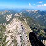
Tegelberg Paragliding

With a weekend of strong winds forecast it was hard to decide where was best to go, after much deliberation we decided to head to Tegelberg as it looked like it had the best combination of airmass and weather. After a late start due to the W/NW aspects after launch it was an enjoyable flight in bumpy conditions due to there being about 4 different inversion layers at different altitudes which were difficult to punch through. It was a very scenic place to fly with views into the Allgäu and into the Ammergebirge, and as the day progressed the conditions became progressively easier. As I ended up with some good altitude at the end of the day, I decided to head for a long final glide over the beautiful Forggensee, to land in Buching just next to my hotel for the night.

Breitebenkopf

We decided to do a there and back route up the Breitebenkopf as we could walk there from the campsite. We started with a 2.5km walk along the road into the Seidlwinkltal before starting our ascent. From the start it was clear this wasn’t a popular route as the ascent was very overgrown, and it was also very steep. The steepness combined with the brutal heat made this very hard work. On the map there was a walking path which made its way directly up the mountain and an old zig-zag forest road, which looked even more overgrown than our path, however eventually we emerged to find the overgrown forest road had turned into a newly made stone forest track. So at this point we decided to leave the official walking track and take the much longer, but much less brutal forest track up to the end of the forest. From here we left the stone path and again joined an old track and then a very unworn path up the spur towards the Weichselbachhöhe. This became increasingly steep towards the top, and we were certainly glad when the summit. Read the full article…

Krumltal/Tal der Geier

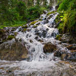
With afternoon thunderstorms forecast and after two days of walking with more than 1300m of ascent, we decided that a rest day was in order. We decided to do a short walk up the Krumltal to the Bräualm for lunch. The valley is best known for the birds of prey, where it is common to see Griffon Vultures, Bearded Vulture and Golden Eagles. What we didn’t realise is that it was also a really beautiful valley which was full of enormous waterfalls. On our walk into the hut we enjoyed admiring the landscape and the waterfalls, and saw what we believe to be a number of Griffon Vultures. We soon arrived at the beautifully situated farm where the Bräualm was situated, where we enjoyed a lunch of their homemade bread and cheese, with meat from their animals. All of this while overlooking the valley where we were watching Bearded Vultures flying, thankfully someone at the hut let us use their binoculars to fully appreciate the birds. On the way out we saw a number of Marmots which I was particularly pleased about, and then just as we were about to. Read the full article…

Grubereck

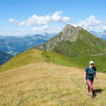
Grubereck is the first high mountain on the eastern side of the Rauris valley which meant that despite its relatively modest height would have excellent views to the north, south and west. We didn’t start as early as we would have liked, as the first bus on the weekend was surprisingly late, which meant we had a very hot ascent up to the peak. Initially on the ascent we had fleeting views over alpine meadows looking north into the larger mountains towards the end of the Rauristal on the way up to the Bründlalm. From here the ascent became very steep and relentless, but we eventually emerged out onto the grassy summit ridge where the views really opened up and became really enjoyable. We were shocked to arrive at the summit and find a very civilised bench with a table, which made it an obvious spot for some lunch, it was just a shame about the flies due to the lack of wind. From the summit we descended to the Karalm, where I was really looking forward to a stop for a cold drink and maybe some cake, however we. Read the full article…

Rauris Ridge

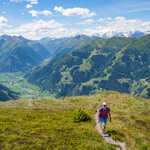
I planned this walk back in spring, but for various reasons we had not got around to doing it. Given the day before a 4 day weekend in Germany was forecast to be perfect weather, we decided to extend the weekend and take the Friday off as well. There were two options for this walk, the first from the valley with more ascent, but less descent, or the second from the lift station, with less ascent but more descent. We decided to do the ascent from the valley, which was certainly hot in the morning sun. The route took us from Hundsdorf, up to the Roßkopf and then up to the Baukogel which was the start of the ridge. The ridge then took us over Hirschkopf and Reißrachkopf before finishing at Schwartzwand. The ascent up to Roßkopf was initially on a track before moving onto a not very well trodden path up through grassy meadows, which was a lovely ascent. As we climbed the views were getting better and better, and in very good time we were at Roßkopf where we quickly ate most of our lunch. From the Roßkopf. Read the full article…

Aiplspitz and Jägerkamp

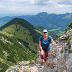
I took Friday off work due to there being a moderately ok forecast and wanting to get into the mountains. As the weather wasn’t perfect we decided to stay in the Bavarian Alps and head back to the Spitzingsee area. This time we elected to do a circuit up the scramble north ridge of the Aiplspitz and then traverse over to the Jägerkamp, before descending to the Spitzingsattel. As we left Munich we were not convinced about walking as it was raining heavily just south of Munich and in the mountains, which was not in any of the forecasts. We decided that as the only thing we were waisting was time we took the train down to Geitau anyway, with the hope that the rain would stop and the plan to head back home on the next train if it was still raining. Thankfully by the time we got to Geitau the weather had significantly improved and we set off on our planned walk. The views were brilliant from the start, with a wonderful view up the valley which we were going to walk up and a view of the. Read the full article…